 Core
Drilling (Geotechnical Investigation)
Core
Drilling (Geotechnical Investigation)
 Geological Investigation
 Geophysical
Surveys
Geophysical
Surveys
 Soil Test for Buildings
and Transmission lines
Soil Test for Buildings
and Transmission lines
 Laboratory
Testing (Soil,
Rock)
Laboratory
Testing (Soil,
Rock)
 Mining Scheme Preparation
 Directional
Drilling
Directional
Drilling
Geophysical surveys are archaeological methods that use ground-based physical sensing techniques to produce a detailed image or map of an area. These methods are neither invasive nor destructive, an important goal when surveying culturally-sensitive sites such as cemeteries.
Our in-house Geophysical Surveying capabilities include:
- Electrical resistivity imaging (ERI) and tomography
- Ground-penetrating radar (GPR)
- Spectral Analysis of Surface Waves (SASW)
- Multi-Channel Analysis of Surface Waves (MASW)
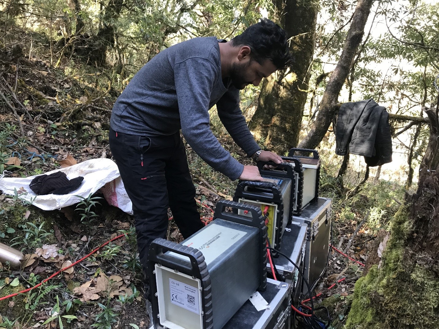
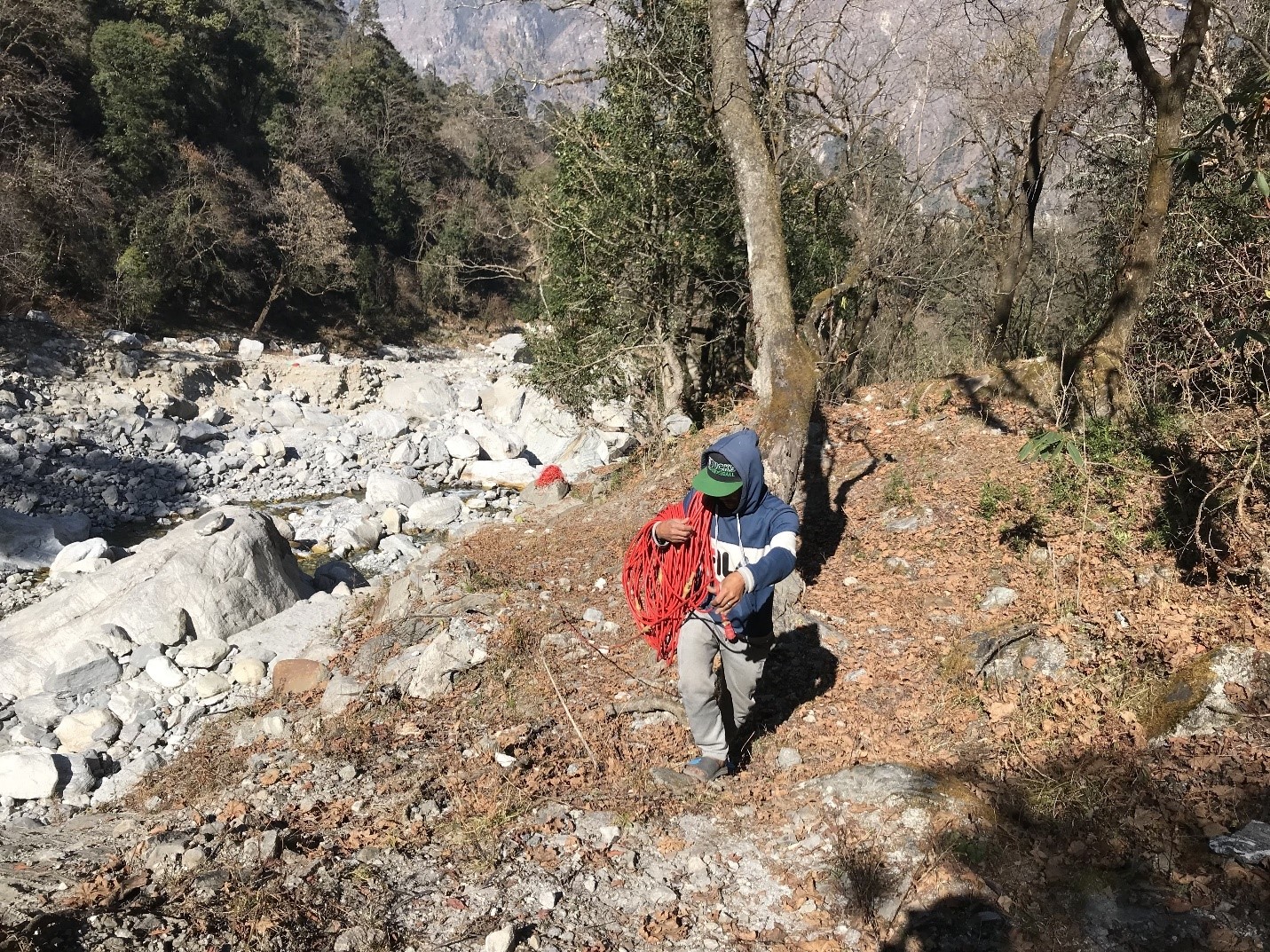
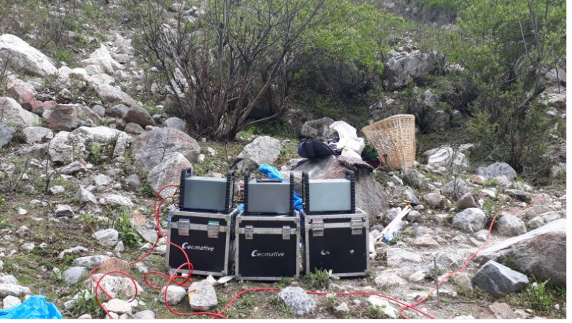
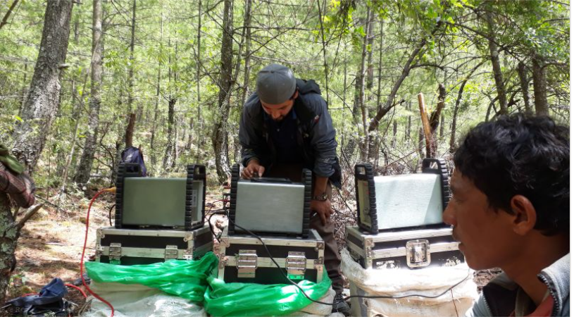
Electrical Resistivity Tomography (ERT) Equipment
Quartz provides electrical resistivity survey for the delineation of sub-surface geology, mineral layer identification, hydrological investigation, and differentiation of overburden and bed rock. We use the Geomative 10 (GD-10) brand machine with 1200m long cable. This equipment can reveal sub-surface data up to 300m depth from the surface.
GD-10 Series Geo-electrical System Features
The GD-10 series is a new electrical geophysical exploration system with highly engineered & cutting edge technology. It supports 1D VES, 2D ERI and 3D ERT Resistivity/IP measurement, making it versatile for a broad range of applications including groundwater and mineral exploration, and infrastructure site investigations.
- Can measure resistivity, time domain induced polarization method (IP) and spontaneous potential (SP)
- High power, wide range, high precision
- Transmitter and receiver designed in one unit, light and portable
- Unique sub-level centralized cable system for electrode switching
- Innovative scrolling technology for deeper detection without repeated measuring points
- Built-in GPS for accurate coordinate determination
- Powerful self-checking function for high-quality data during measurement
- Real-time data evaluation
- Robust design for use in extremely harsh weather conditions
Our GD-10 Advanced 2D Multi-electrode Res Imaging System includes the GD-10 mainframe and CS-60 multi-electrode switching box with power specifications of 800V/1600Vp-p, 4A, 3200W.